Log in
Register
Crisis information sources
CIK Activities
Operational products
Publications
New technologies
Menu
News
Operational products
Activities
Projects
Current projects
Finished projects
New technologies
Publications
About Us
News
Filtruj po:
Data od
Data do
Sortuj
Rosnąco
Malejąco
Tagi
17
July 2020
Geoinformation Guide: Earth Explorer
In today's article from the "Geoinformation Guide" series we will show you how to download free satellite images, eg from the Landsat mission, in a simple and quick way using the Earth Explorer browser.
12
May 2020
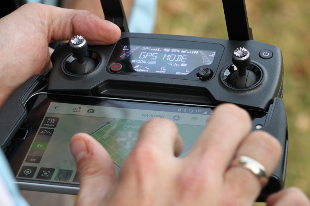
Support of the Crisis Information Centre CBK in the use of UAVs during the fight against fire in the Biebrza National Park
The recent fire of Biebrza National Park has been one of the biggest challenge for rescue services and crisis managements units in Poland for years. More than 5,5 hectares were burnt. During fire service action there were used special planes and helicopters because of hard-to-reach peat and swamp areas. UAVs were used for situation assessment and place of incident documentation.
30
April 2020
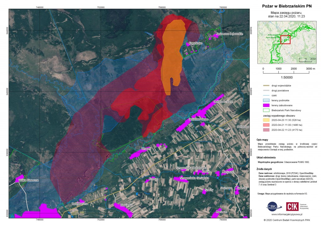
Fire in the Biebrza National Park observed from orbit (new maps added 30 April, 17:00)
Experts from the Space Research Centre of the Polish Academy of Sciences used the satellite data to determine the extent of fire in the Biebrza National Park. Observations have shown that the fire area increased eightfold between 20 and 22 April 2020 reaching almost 4200 hectares.
10
April 2020
Happy Easter 2020
Wishing you lots of health, beautiful time with your familiy and nothing but smiles, sunshine and optimism. Happy Easter 2020 !
07
April 2020
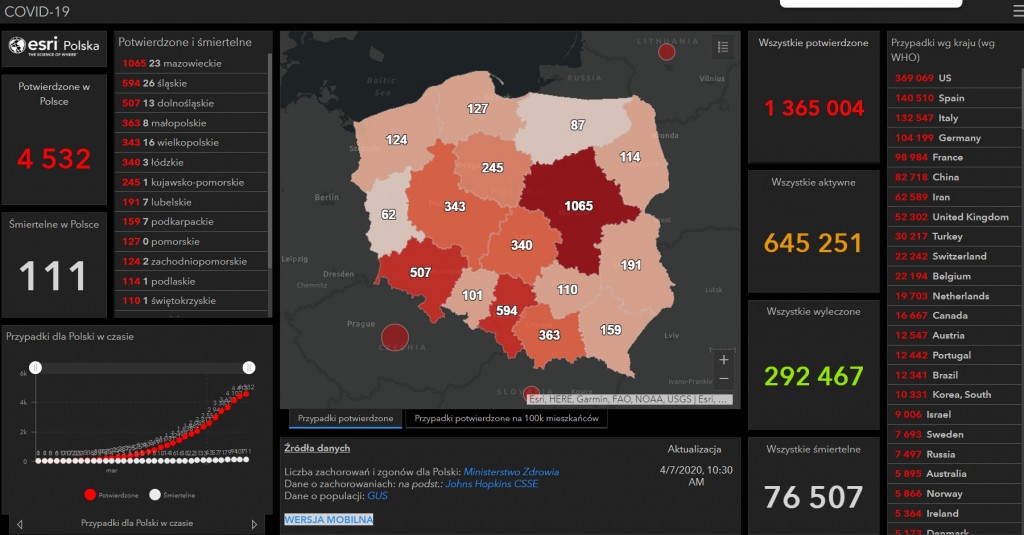
The overview of the COVID-19 maps for Poland
We present below the overview of the most interesting web maps dedicated to COVID-19 monitoring in Poland.
31
March 2020
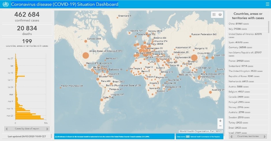
The overview of the COVID-19 maps for world
We present a list of the most interesting web maps monitoring the development of the to COVID-19 pandemic in the world.
30
March 2020
Covid Challenge Competition
We are looking for ideas of devices, methods, actions or processes using in the fight against COVID-19 pandemia. Take a look at the challenges and take part in Covid Challenge.
26
March 2020
Project HERoS - more effecitve fight with COVID-19 pandemia
Specialists from Crisis Information Centre, Space Research Centre of Polisch Academy of Sciences will take part in the project: Health Emergency Response in Interconnected Systems (HERoS). The overall objective of HERoS is to improve the effectiveness and efficiency of the response to the Covid-19 outbreak. The project is funded by EU (H2020 project under the H2020-SC1-PHE-CORONAVIRUS-2020 funding scheme).
12
March 2020
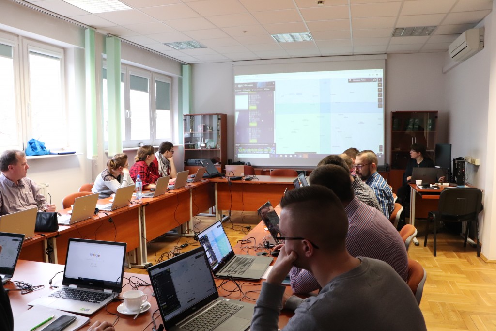
The DRIVER+ Advanced Crisis Management Conference - outputs and achievements
On 18-20 February 2020 the DRIVER+ Advanced Crisis Management Conference was held in Brussels. The main aim of the conference was to summarize DRIVER+ project’s achievements. More than 300 crisis management specialists, scientists, providers of advanced solutions and the European Comission and EU countries representatives took part in the event.
04
March 2020
I Forum of geoinformation users in crisis management and rescue (postponed)
Due to COVID-19 pandemic, the data of Forum is postoponed. Probable new data: autum 2020.
10
February 2020
Two years of the Mobile Centre for Satellite Data Analysis and Development
The Mobile Centre for Satellite Data Analysis and Development (MCS) has been operating at the Crisis Information Centre of the Space Research Centre of the Polish Academy of Sciences for more than 2 years, offering operational geoinformation support to emergency management services and institutions.
15
January 2020
Summary of the year 2019 in the Sat4Envi project from the perspective of CBK PAN
The second year of the project “Operating system for gathering, sharing and promotion of digital information about the environment - Sat4Envi” is behind us. It was a year full of new experiences, so we would like to remind you of the most important Sat4Envi events in 2019.
07
January 2020
Union Civil Protection Mechanism tests the DRIVERr+ tools
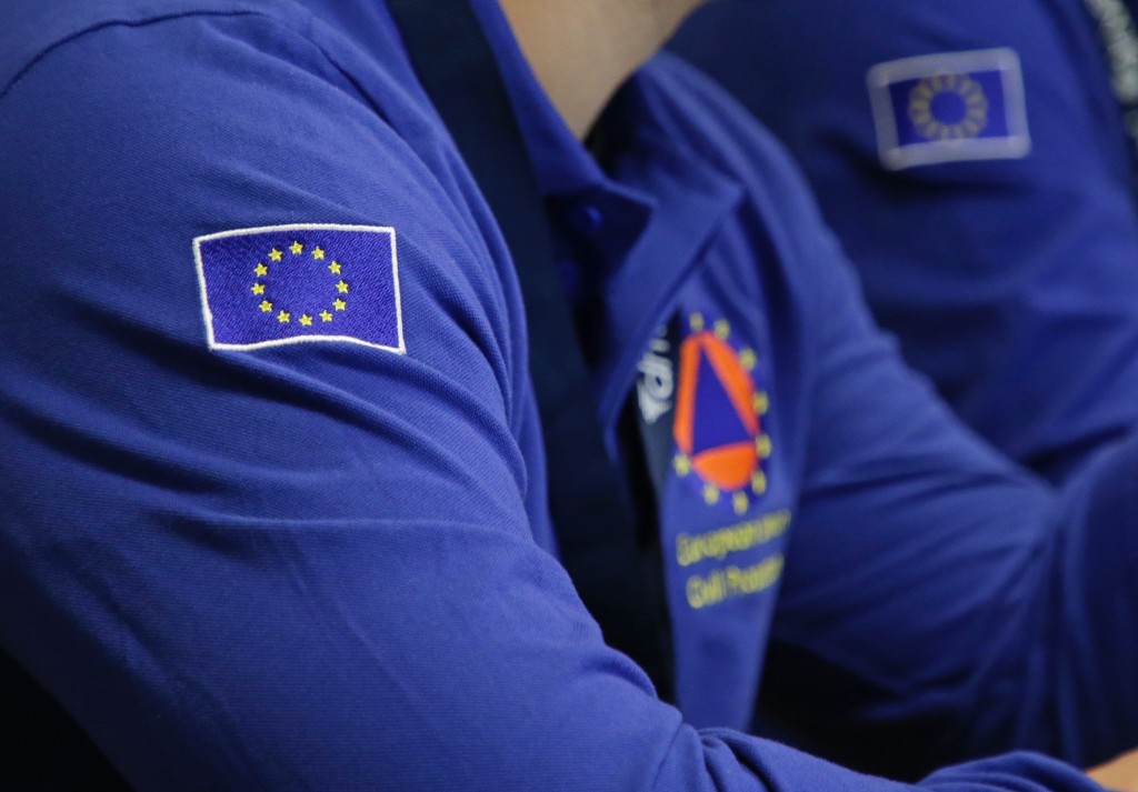
Union Civil Protection Mechanism is the highest Crisis Management coordination body in the European Union. The primary aim of the UCPM is to strengthen cooperation between Participating States – Members States and others affiliated in the UCPM – in the field of civil protection, in order to respond to disasters as effectively and synergistically as possible. It demands a tremendous coordination effort and it was the main topic of Final Demonstration organised by Space Research Centre of Polish Academy of Sciences and the Main School of Fire Service under DRIVER+ Project.
19
December 2019
Training for inspectors from the Provincional Inspectorate for Environmental Protection in Warsaw
On 16-17 December 2019, a team of specialists from the Crisis Information Centre CBK PAN conducted a training for inspectors of the Provincional Inspectorate of Environmental Protection. (WIOŚ). The training covered selected issues of geographical information systems and remote sensing.
12
December 2019
Centre of Expertise will support in using DRIVER+ outputs in crisis management
The first Centre of Expertise DRIVER+ (CoE) wil come into being in Poland. CoE is an organisation operating in the domain of Crisis Management and Disaster Risk Reduction that acts as the primary contact point for practitioner organisations at the national or regional level, supporting their capability development and innovation management.
«
1
2
3
4
5
6
7
8
9
10
11
12
»
Ten serwis wykorzystuje pliki cookies.
Korzystanie z witryny oznacza zgodę na ich zapis lub odczyt wg ustawień przeglądarki.
Log in
The Address e-mail field is required.
The Address e-mail format is invalid.
The Password field is required.
The Password must be at least 7.
Forgot password?
Reset your password
The Address e-mail field is required.
The Address e-mail format is invalid.
Registration
The Name and last name field is required.
The Name and last name must be at least 7.
The Name and last name may not be greater than 50.
The Address e-mail field is required.
The Address e-mail format is invalid.
The Password field is required.
The Password must be at least 7.
Passwords dont match.